 Being a bit of a boat nerd, I was fascinated to find the website marinetraffic.com which shows the position of all the major boats around the world. As well as showing the position and direction of each ship, you can click on the marker and see full details including photographs. OK, so the vessels tend towards the larger and less modellable types but it’s still fun to watch.
For example, as a keen Isle of Man fan, I can watch the progress of the fast ferries from Liverpool. In fact the system is so good, I can watch the ferry approach Douglas harbour and then bring up the appropriate webcam to see it arrive. Can you tell we are quiet at work at the moment ?
Even railway modellers can enjoy tracking boats – if you can find out what the name of the vessel carrying the next batch of goodies from China is, you can track it and know when your local shop can expect its next delivery.
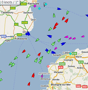
What amazed me is the sheer number of boats out there. Take a look at the English Channel and it looks like a busy motorway. Once upon a time the cargoes from all of these would have been offloaded and sent on their way by rail. Now it’s a mix of road and rail transport but all this is like blood running around the veins of the country and keeping it going. When we build models it needs to be remembered that we are illustrating just a tiny slice of this world. Beyond the boundaries of the baseboard there is the rest of the country to consider. I know people bang on about proper operating of model railways and I’m worst than most at paying any sort of attention to this, but when you see the high level view of the transport system in operation, it does make me think there is a whole lot out there I simply don’t understand.
No comments:
Post a Comment